
Two readers are stirring the Suggestion Pot with map-making questions.
BladeMaster0182 writes:
Hi guys. I would like an article on mapmaking. Every DM does it and I couldn’t find an article on it. I know many of us do it by hand but some of us (like me) lack the artistic talent to draw out their dream world. There are some map making programs, but most I have found are overly complicated, or do not look very good. How do you guys do it in your campaigns?
Patrigan writes:
I’d like an article with regards to building a city. Tips and advice for drawing the floorplan. The important assets that any city requires (like mayor). And how to fill in specific story stuff into the city.
Maps. The DM’s outline. I’ve known DMs who run entirely off the map. There are DMs for whom the inspiration for their entire adventure comes from the design of the map. A map keyed with sticky notes noting monster and treasure is all they need.
Others require something approaching professional quality – clearly labeled, the starting point for a well-organized campaign or single-session scenario, accompanied by a fully fleshed-out script.
For those – like me, and admitedly BladeMaster0182 – without a smidgen of artisitc talent there is hope. Yes, you can have maps that meet your needs. And for Patrigan, who wants to bring his setting – in this case, a city – to life, there are a few tips here than can also help.
Do it yourself
First off, it needs to be said: You don’t need to create your own professional quality maps to be an effective DM. (While I don’t want to discourage anyone from trying an art computer program to unlock the cartographer within – my experience is that they are advanced tools for the serious artist.) Before investing in expensive software, consider these many options, first.
1. Graph Paper. There’s nothing like a sharp pencil, a ruler and a grid of lines made of printer’s cyan to get the creative juices flowing. I don’t know how many hours I’ve spent drawing combinations of rooms, ruined castles and the dungeons and caverns that lie beneath. Call it “Old School,” if you will, but it’s a great exercise and only requires you to draw a straight line with the help of a straight edge. Start simply, a long hallway with one intersection. Add doorways and rooms to the adjoining halls and ‘Presto!’ you’ve got the setting for an evening’s fun entertainment.
2. Tiles. Great tools, tiles, especially if you draw inspiration from more tactile experiences. Nothing beats a bag of Scrabble letter tiles. Arrange these on a tabletop, each tile representing a 5-foot square. Again, start with the intersecting hallways, add some rooms and see where it leads. Don’t have Scrabble tiles? Cut the aforementioned graph paper in to quarter-inch chits and do the same thing. Take a picture of the finished product and print out it out (instant map) or record what you’ve created on graph paper.
This is now my preferred method, though I’ve made some investment in other tiles along the way. Wizards of the Coast publishes sets of Dungeon Tiles that can be used this way, and there are a number publishers, including Skeleton Key Games and Fat Dragon on rpgnow that offer sets for download that you can print out yourself onto cardstock.
Of course, now I use tiles made of plaster molds to really give me a 3-D effect, a do-it-yourself version of the Dwarven Forge dungeon sets.
3. Freebies. Can’t draw? Assembling tiles sounds like a chore? No sweat. In its archives, and even as a preview of its Fourth Edition products, Wizards of the Coast offers oodles and oodles of professionally drawn maps. Most are from past products and other online features still available for a free download. Print them out and key them yourself. In all likelihood, there’s going to be something that matches your needs.
Right now, in fact, I’m taking the “Keep on the Shadowfell” free download at Wizards and using two levels of its dungeon maps for a new adventure. (Shhhhh, don’t tell my players.)
Personally, I’m partial to the Maps of Mystery, many created by Chris West, that appeared in many back issues of the print versions of Dungeon magazine. In fact, Dungeon itself is a great resource of maps. Every published adventure had them. If you have an archive, grab an old map and key it anew.
Beyond the dungeon
Most of the advice, so far, has been about creating maps for dungeons. But Patrigan is looking for tips on cities. But more broadly, city and wilderness maps fall into much the same category. You want a map of the “big picture.”
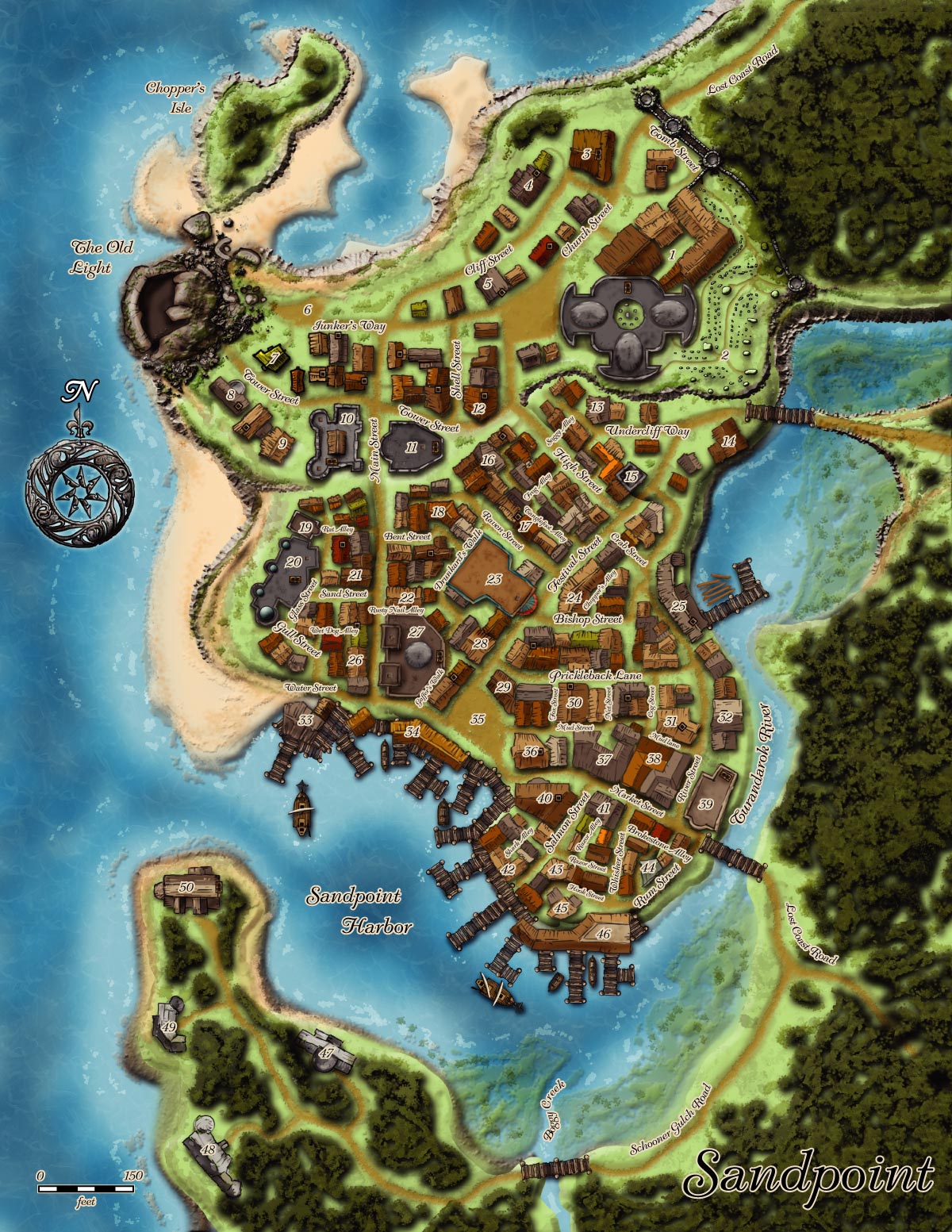
4. Use real-world maps. A coastline is a coastline, right? A street map is a street map. In fact, using real-world maps adds a grounding in the game’s “reality” that can’t be beat, because it is real. Designer James Jacobs has said that his hometown served as the basis for Sandpoint, the town central to the Rise of the Runelords Adventure Path.
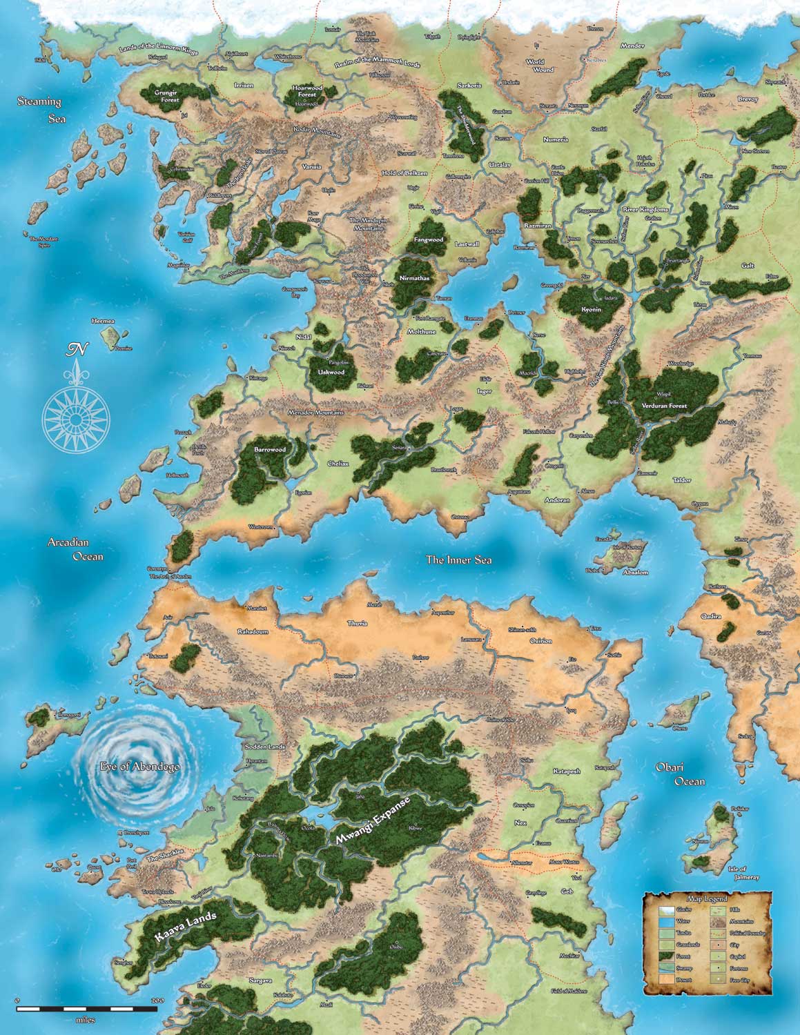
Now, if you use the outline of Europe for your realm, that’s going to be a dead giveaway. Turn your maps upside down or inside out to make them unfamiliar. Trace only a portion that you think is relevant. Use remote, out-of-the-way places that only a geography bee participant would recognize. And there’s nothing wrong with using a portion of a published campaign map, such as the Realms or Paizo’s Golarian, and putting your own stamp on it.
From Pulp Gamer, I’ve learned that a gaming group in Arizona uses the state map, and all its geography, as its realm. The only difference is that Arizona is now a fantasy landscape. Go to just about any historical site in the U.S., and maps accompany most of the freebie brochures. I can tell you that a local landmark, Starved Rock State Park, will be a featured locale in my game very soon.
5. Blank Sheet on a Wall. Generally, this is a collaborative exercise, by which you elicit input in a roundtable fashion from your other gaming friends. But there is no reason a DM can’t brainstorm solo this way, too. A big blank sheet of paper (or a chalk board or a whiteboard works too, so long as you take a photo of it later) is taped to the wall. Divide it into quadrants, if you think that will help organize your thoughts. Then draw a broad outline of what you’re building, such as a city for Patrigan or a whole realm for Blademaster0182.
Mark “home” or “town center” in the center of the map, and then go around the table, getting suggestions from folks on how to fill in the map. These can be actual geography or street layout, adventure locations, interesting features (natural or manmade) or even places that interesting NPCs or monsters inhabit.
Now this kind of “map” is less likely to have perfect coastlines or street details. But it will be loaded with adventure power. And all of it will have been designed by your own group, so as a DM, you will know exactly what kind of adventures and challenges they are interested in overcoming. In addition, it gives them “ownership” and the kind of player knowledge that is slow to acquire with a published setting. Once the players help build the world – or at least flesh out the broad strokes – it will be like they have lived and grown up there. As for the DM, the details – and all the dangers – are up to you.
City building exercise
It’s hard to make an exhaustive list of everything a city needs. Fantasy cities, though, share a lot more in common with modern urban areas than their actual historical (especially medieval) counterparts. I played a lot of SimCity when it first game out, and that simulation is really good learning tool on the nuts’n’bolts of urban design.
Rely on common sense and need. If the players need something, sage advice, equipment or allies, and it makes sense to have it, then include it. But the top of any DM’s plan should include a ready list of a dozen NPCs the players are likely to meet and a half-dozen potential adventure sites. At this stage, all of the descriptions need only be a line or two, and not even statted out. A city is sandbox, and once your players indicate the type of adventure they’d like, then you can begin the process of adding in details.
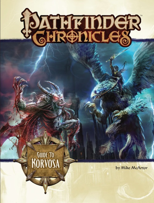
And if you already possess an urban sourcebook, such as Sharn: City of Towers or Waterdeep, Greyhawk, my personal favorite, Korvosa, or even by good fortune Ptolus, then those all serve as an excellent model as to what belongs in a fantasy city, and their appropriate placement therein.
I’ve come to rely on Cityscape and the Arms and Equipment Guide as two ready references. But before that, this web enhancement that went with the 3.5 version of the Dungeon Master’s Guide is a great starting point for populating a city on the fly.
Paper and Pencil
Above all, be fearless with the simplest tools, a pencil and a scrap of paper. A DM’s map is a treasure trap in the best sense. Even the simplest scrawl, so long as you the DM knows what it means and stands for, is the X that marks the spot. With some players willing to explore the unknown – and your own intuition – you’re guaranteed to have a fun adventure.


Thank you for writing this article. My 4e campaign is like a half-sandbox. As in, the players have a specific mission, but instead of having a series of plot events, I reason out what each NPC would do in the current situation and improv it. I would love to present my PCs with a nice map of the continent so they get a better grasp of their options. Unfortunately, yeah, no skill. If you wrote up an article explaining, in detail, how to make respectable overland maps with little drawing skill, you would officially win the D&D blog game.
Yeah, I’m a map nerd.
I used to draw all of my campaign maps in photoshop(equivalent) with layers for all of the different features: urbanization, forest, dungeon sites, roads, etc.
Now I just use arcmap. Sure, its a wee bit of overkill, but for having all of your maps at whatever scale you want, it can’t be beat.
That said, for around the table play, using the 1″ grid paper pads for meetings (the 1 square meter or so things). Toss a clear sheet of acrylic over it, and you can mark it up with whiteboard markers, and it comes with a grid already. A set of coloured sharpies goes a long way.
As to actual regional mapping, spend time looking at real world maps. Have a look at a basic physical geography or intro geology textbook. Mountains and rivers don’t just happen at random, and if you want something that looks real you have to respect certain placements. Think about how weird Moridor looked with that square box of mountains.
Also consider scale. Without knowledge of how to calculate longitude, distances on maps were fairly approximate, especially over water. (look at early maps of north America, and how that white space in the middle lead it it being a very wide continent). Have a look at Inuit maps where scale is dependent on the importance of the feature, not the size of the feature. Look at people’s quick drawn map to the corner store. Perhaps a fixed scale isn’t the most period or flavourful option.
And finally, make handouts of maps. Probably with a lot less detail than your actual campaign map, but it adds a lot to the players to have, hold, and annotate their own map. Especially when it is just a little wrong. Cheap maps may take liberties.
Thanks for the ideas.
I really like the Chalkboard one. That’s something I can work with, even when designing cities!
The place to go for a bazillion maps by talented folks with awesome advice for making your own is http://www.cartographersguild.com/
I am in love with this resource and use it a lot for my game.
Phil.
Newbie DM had a decent article on mapping. I have yet to try the first program he offered up, AutoRealm, but I found Terragen to be confusion personified.
@quatch – Now I just use arcmap.
Which actual program is this? ArcView, ArcEditor, etc? Looks handy!
@Rafe – ArcMap 9.2, student edition (its a wee expensive otherwise). I use arcview for most everything as the multiple layers at a time is a must. I’ve done a bit of DEM interpolation and used the 3D flyover with some success. I’ve been toying around with Quantum gis, which is open source and should be able to do the same, but I’ve not learned it yet.
My large maps in a straight image editor, just got too large, and my computer couldn’t handle them. I either had to choose a low resolution, or a small area, neither of which was desirable. They looked quite snazzy though.
I enjoy maps– probably a little too much. I know that some of my early campaign worlds were long on historical movements, but light on adventure.
If you’re looking at a nation scale map, I like tracing its outline at most of the size of a sheet of paper and making photocopies, then filling in. That lets me make mistakes and toss bad copies– which can be good if you decide to start coloring in terrain.
I love using maps. Graph paper, dry eraser boards, sticky notes, doodles during a boring class, or whatever- all great.
The problem that I find with maps is that they lend you to be dependent on them. I think that you can lose the ability to fudge things to make it work better when the maps are too concrete. Of course if you go for realism, then concrete is the way to go. I just don’t like limiting myself by being too attached to my maps.
Timely and awesome article. I just picked up campaign cartographer for myself. I’m going to be taking some time to get really good at map-making over the rest of the summer. I generally draw out crude maps on sheets of paper, or just use dominoes, but I want to get some more high quality stuff done.
I have just strated using an updated version of the WoTC Dungeon Tile Mapper (from 3rd E). Here is a yahho group devoted to it.
http://games.groups.yahoo.com/group/dungeon_tiles/?yguid=212327341
Great article. I really love the fact that you have links to many of the material we would need embedded in the article. Thank you for the help!
I find map-making is a big part of world creation for me. That seems obvious, but let me distinguish between two types of world creation I do: the world creation that piles up in giant unsorted piles, which notes everything from succession rituals in Goblin monarchies to tattooing patterns among orcish tribesmen, and then the world creation that actually results in an adventure. Putting places on paper (and I’m quite old-school, that way) and looking at the relationships between them suggests obvious plot hooks. You look at where the players start and start filling in their surroundings with scary places for monsters, less scary places for adventuring, and halfway decent places for R&R. A good map conveys your world’s politics and history much better than an hour of lecturing your players.
My only real problem with using “ancient technology” is that I often want to make an incomplete copy for my players to use, and that’s a little harder without a computer. I also tend to get very proud of my finished maps, but don’t get to share them all because they’d give away too much! (Here be dragons… no, really).
@Bercilac – If your maps are small (mine frequently arn’t), put white masking tape (or paper) over the no-show areas and photocopy.
That, or redraw with ink & nib-pen (or brush), with a slightly-off scale (don’t trace). Then you get to add all of the map-art joy.